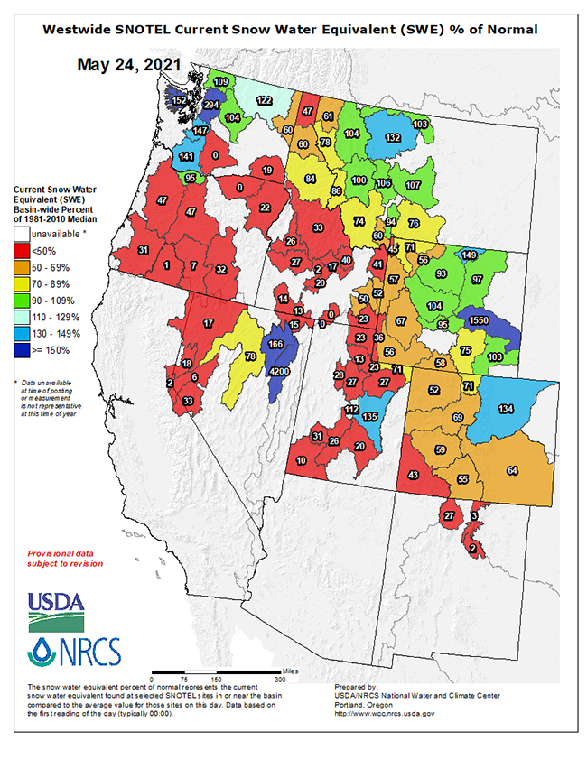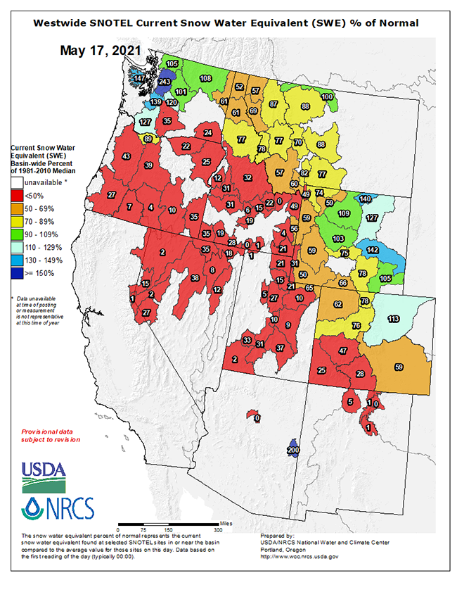
A week ago I posted the snow water equivalent graphic below for the Western US and echoed the concern that many were expressing at the time about snowpack loads in much of (most of) the West.
Today’s SWE graphic above does show some decent improvement after a wet and chilly week across at least the northern tier of the West; it’s impressive how much difference one decent system can make in terms of snowpack this time of year…


