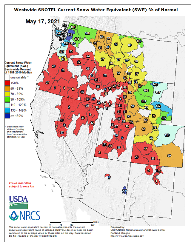
Today’s snowpack snow water equivalent map above (current as of this morning) looks pretty damn dismal for most of the West; northern WA and central WY have the best snowpack loads of the group, and the rest of the West runs from pretty damn skinny to dismally low.
We just drove from Southwest Montana down through Southern Idaho, Utah, Southwest Colorado, and across central NM – much of that country was shockingly dry for mid-May…
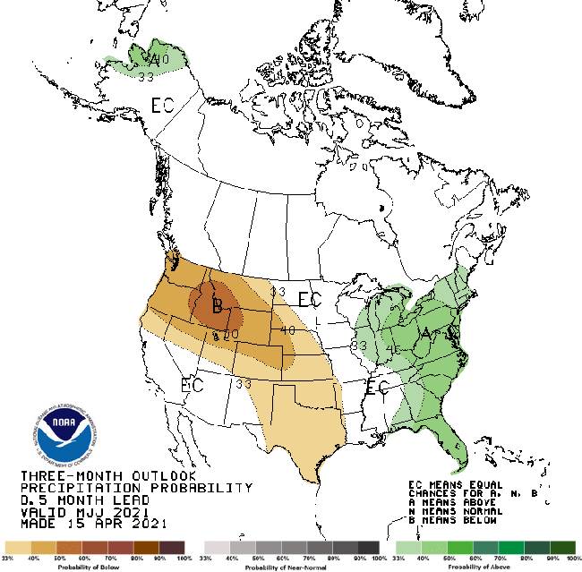
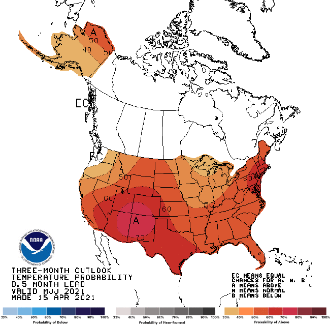
Looking at the three month precipitation and temperature forecasts from NOAA climatology gurus suggests the late spring / early summer window is going to be warmer than average and dry (next two images below), so what water is up high will be coming out on the front end of the season.
Prepare for low flows and a robust fire season this year…
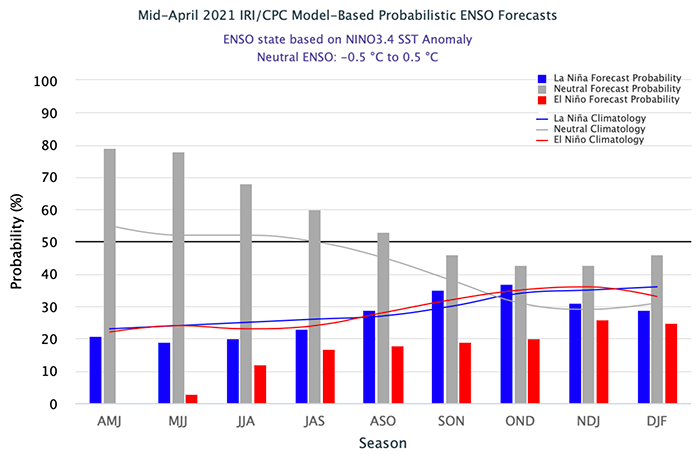
One glimmer of hope in the longer range forecast is the rising odds of a weak La Nina in Q3 and Q4 of the year – that cycle tends to push cooler weather and more moisture across the northern tier of the country…