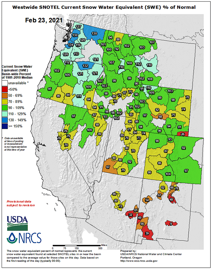
Western snowpack has strengthened across the northern tier during the past 30 days or so; SWE (snow water equivalent) values are up per the graphic above, which is current as of this morning. Most of MT has edged up over normal, and the Yellowstone area is looking pretty good right now, as is the mountain country of OR and WA.
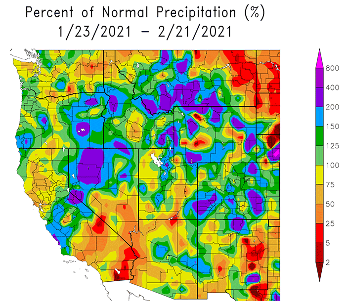
The past 30 days precipitation (as a percent of normal for the period) is graphed below, with damned impressive bands running from eastern OR across mid-ID into the southern tier of MT.
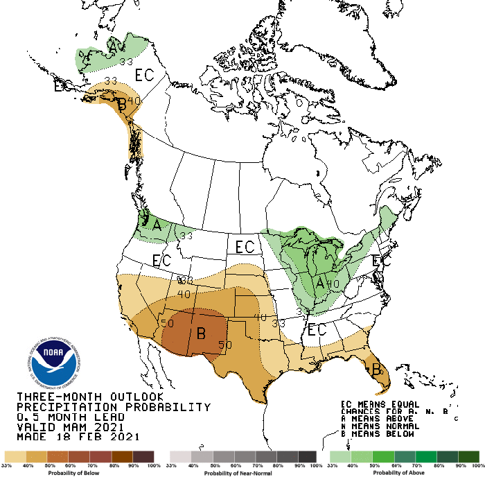
We’re entering the most critical window for building spring snowpack in the Rockies; the current 3 month precipitation forecast (bottom image) suggests that most of MT, WY, and ID can expect normal seasonal moisture, but things might get skimpy for CO and NM.
Don’t stop the snow dances yet.