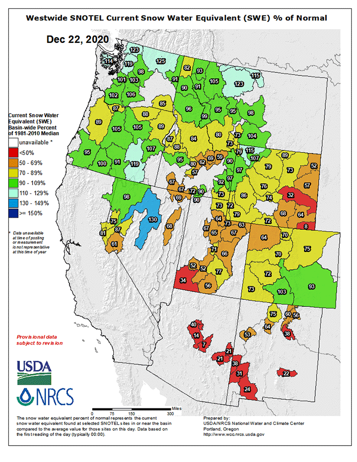
Snow Water Equivalent (SWE) for the western US is running close to average across the northernmost tier (as predicted) and thus far most of WY, UT, and CO haven’t seen much snow laid down compared to longterm averages. It’s obviously very early in the snowpack building season with a boatload of winter yet to come.
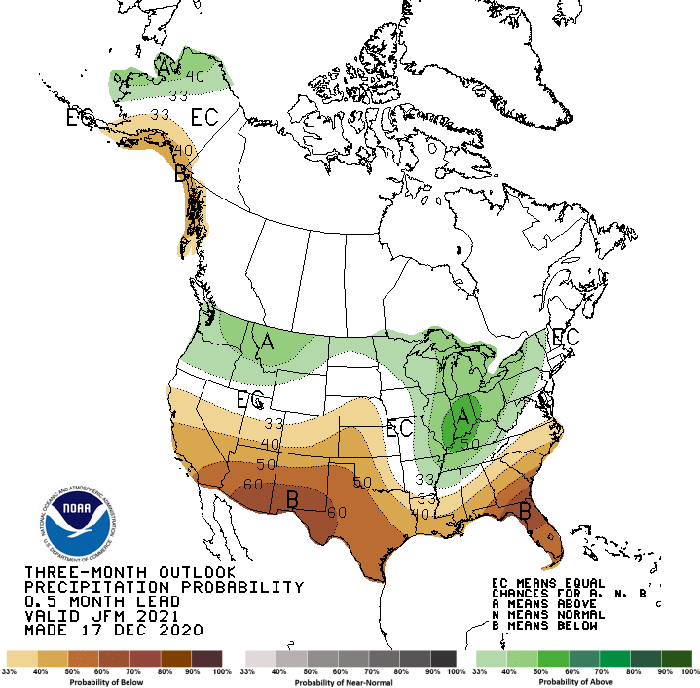
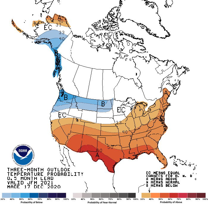
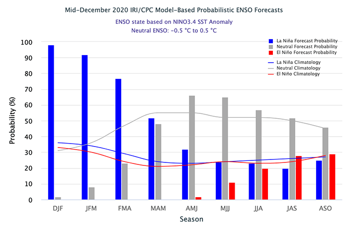
Climate forecasts for Q1.21 are out, with precipitation the first graphic below and temperature projections the second; the projections certainly look encouraging for WA, OR, northern ID, and MT at least, providing that the La Nina event that is currently in place holds, as it should from the ENSO forecast (final image below) through April or May.


