Ever since being properly educated by a former nurse at my clinic in the Flathead years back as to the vital importance of late seasons rains in the valleys and snow up high in terms of snowpack entering the summer season, we’ve always found it interesting to keep an eye on late spring storm events in the Northern Rockies and follow what happens to the snowpack.
It’s frankly a piece of cake with today’s technology, and the last month provides a great example of how true her sage commentary was. (Our nurse had spent a prior career in her younger days as a Forest Service biologist tramping through the wilds of northern Montana and Idaho, day in and day out, in all seasons and in all sorts of weather.)
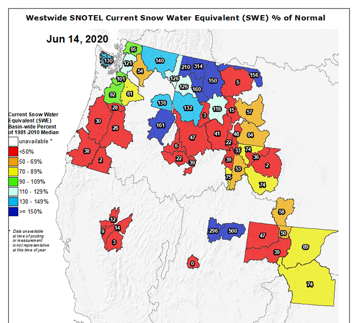
The image above is the Snow Water Equivalent map for part of the Northern Rockies chain as of yesterday afternoon, obviously some stations are fully depleted at this point and not reporting SWE, and much of the mapped area looks pretty damn dry.
On the other hand, northern Montana and Idaho more so than Washington are way above average for this time of year, as is a fairly small zone (in part at least corresponding with the Unitahs) in northeastern Utah.
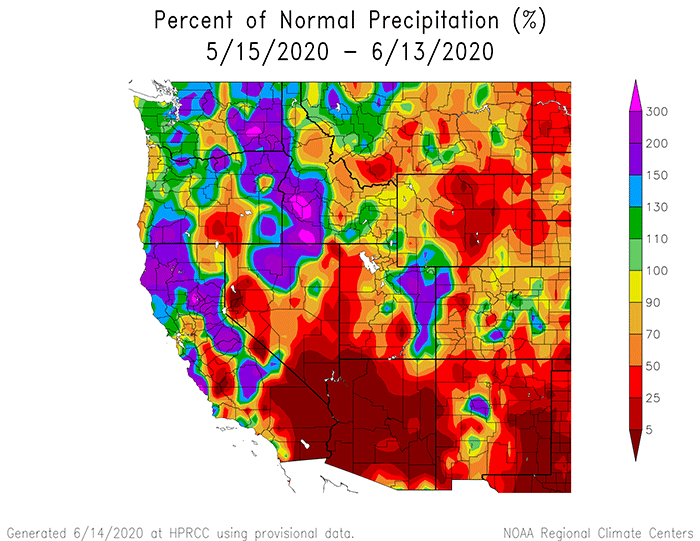
Looking back at the 30 day precipitation map below, it’s easy to match up the late season storm zones with the hefty bumps in SWE. I happened to be driving across the northern tier from Seattle to Missoula a few weeks ago during one of those storms, Lookout Pass was actually pretty messy, and it spat snow from there on into Missoula.
Late season storms are a fly fisherman’s friend.