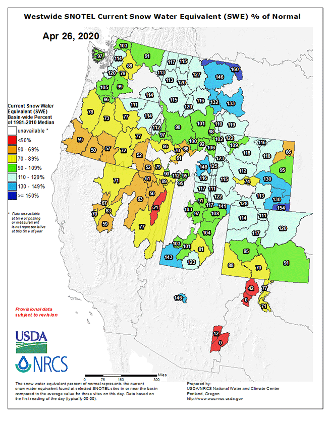
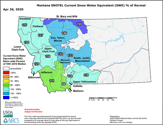
Western Snowpack (as SWE) Looks Decent at This Point
The water year for the northern Intermountain zone of the Western US has been decent, yielding above average snow water equivalents in recorded snowpack as per yesterday’s data below, with a focus on Montana in the second image below. As always there are a host of variables that determine how quickly snowpack becomes water flowing in your favorite river system in the West as we move from late winter to spring, how stream flows will fare through the long summer and early fall days, and what challenges the Western fire season will bring (as noted before, heavily influenced by mid- and late-spring rains). All in all, as of today, SWE looks encouraging.
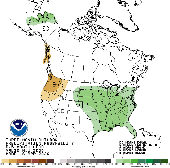
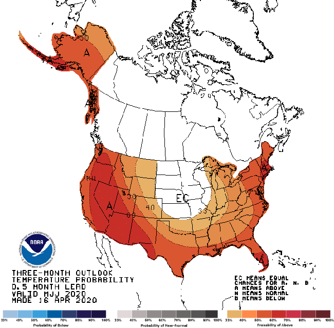
Quick Look at the Forecast Trends for May-June-July
Trend forecasts for May June July are posted below, both posted by NOAA 16 April 20; warmer than normal temps could start water moving out of low and mid-levels early this late spring. As proof, Jake saw the first blush of stain in the Yellowstone over the past few days in Livingston…
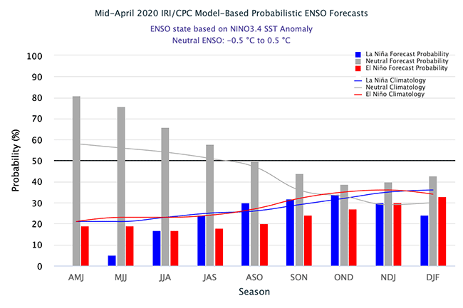
The All Important ENSO Forecast
And finally, with weather and water for the Northern Rockies so critically and obviously impacted by the ENSO flows, here’s the latest projection data from Columbia’s IRC (more here).