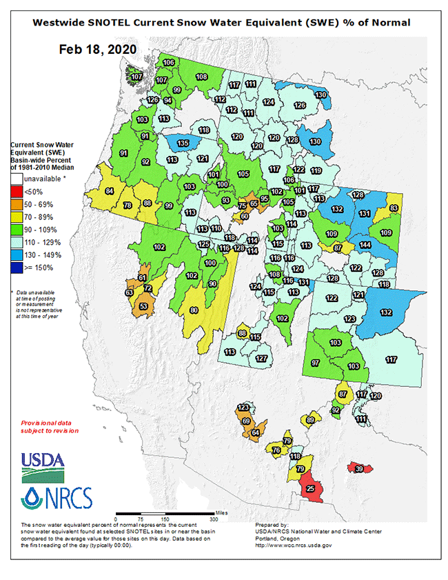
It’s time once again for an update on the snowpack build for the Western half of the country, and things don’t look too shabby for this time of the year for most of the Rockies Chain at least. This morning’s Snow Water Equivalent chart by river basin is posted above and shows large swaths of MT, WY, ID, UT, and CO with above average SWE sitting in basin drainages as of today.
I happened to stumble across a new site yesterday – the Intermountain West Climate Dashboard page of the Western Water Assessment portal – and pulled a couple of interesting graphics from there, posted below.
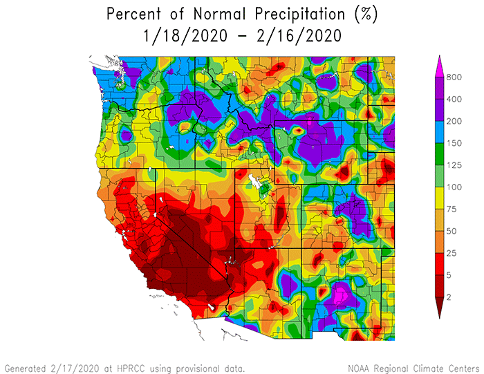
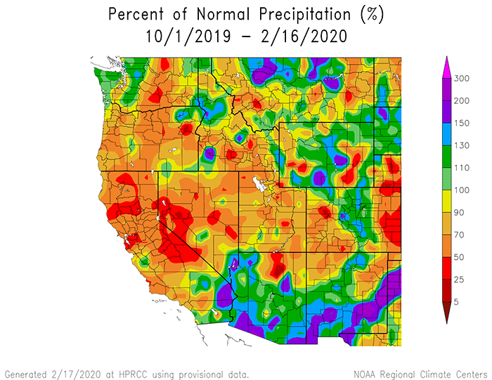
The first is the percent of normal precipitation that’s fallen over the West in the past thirty days; the lower image is the percent of normal precipitation that’s fallen over the West during the current water year (from 1 Oct 19).
For those compadres planning to fish the West this year, by all means keep doing your snow dances, as we’re entering the most critical window of time for laying in the water we’ll be enjoying all summer and early fall.