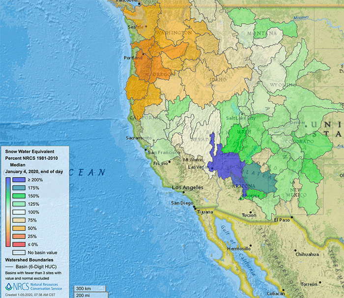
Granted it’s far too early to infer where the Western snowpack will end up by the end of May, though it is interesting to see how snow water equivalent currently stored in the hills stacks up against historical averages for this time of year.
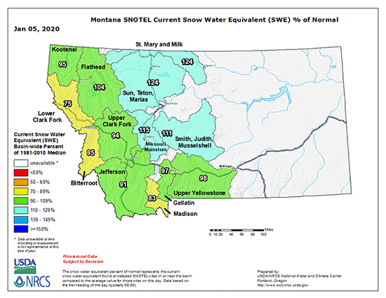
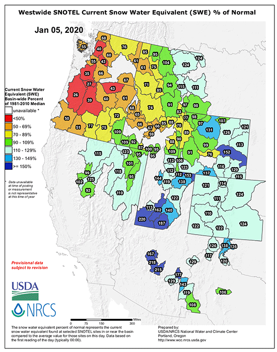
The two graphs above, harvested this morning and showing SWE for Montana basins and the greater West show the early winter season has been reasonably kind to Montana, and even more so to Wyoming, Utah, Colorado, and somewhat uniquely of late – northern NM.
The image below is a screen grab of a new interactive site from the USDA NRCS – you can fiddle with it here – looking at current SWE as a percent of the NRCS median derived from data 1991-2010.