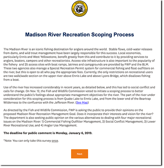
The good folks at Montana’s FWP recently sent out the above email to subscribers reminding them of the recently opened scoping process as they as a regulatory entity – and many others – grapple with the tussle ongoing over traffic on and usage of the beloved Madison river, with the focus on the stretch running below Quake Lake to Ennis.
Given a series of not-so-well-disguised legal threats from certain parties involved in the “discussion” earlier this year, I’ve chosen to not devote a great deal of time to the issue of late, though it’s absolutely critical that the public weigh in during the scoping process recently opened by FWP, and scheduled to run via the survey (screen shot of the opening page below) interval through 6 January 2020.
The thoughtful fisher and recreational river user will look at the hard data and note that “saving the river from being loved to death” simply can’t be done by only restricting commercial traffic. IF indeed river usage exceeds the river’s true carrying capacity as some continue to suggest, it’s frankly counter-intuitive to represent that restricting a minority of usage somehow solves the issue(s) at hand, and once again suggests other grounds at play. IF indeed river usage exceeds the river’s true carrying capacity as some continue to suggest, then all users’ access should be regulated and reduced, invoking a flood of other contentions, including the walk/wade accessibility concerns raised during the tussles earlier this year.
More to come.