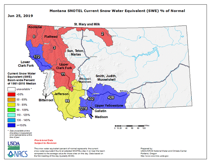
Some areas of the West have experienced snow loading in the high country through the late spring, and even early summer by the calendar, at levels that are pretty damned extraordinary. From the Montana SWE map above, and the Westwide SWE map below, it’s clear that south central MT and northwestern and western WY have been hammered by late season snows, with snowpack SWE multiples above normal (2278% in the Madison drainage!).
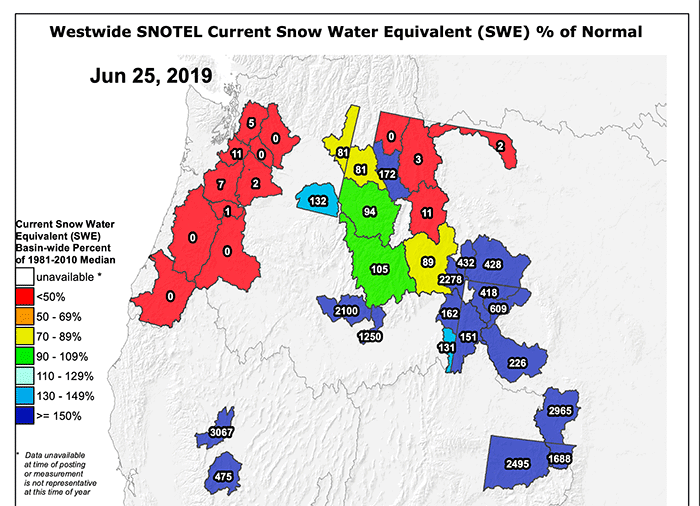
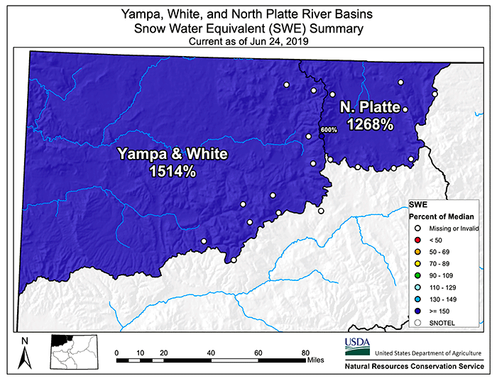
Highest SWE load in the nation is in the Yampa and White drainage in northwestern CO by the national map above; the state/regional map below shows it a little lower, but damn, regardless of which map you want to argue from, there’s a lot of water in some of the hills of the West as we enter the summer season.