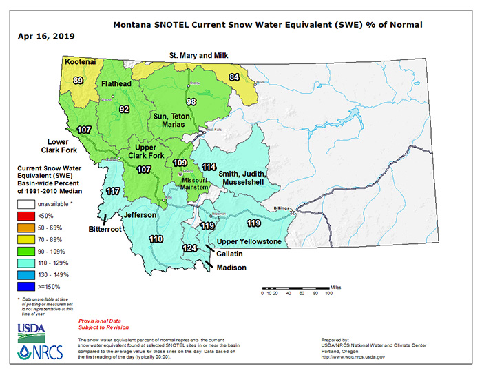
Honing in on Montana above, Snow Water Equivalent measurements as of this morning look pretty robust for this time of year across southwestern Montana, and close to average for the remainder of western Montana, save for Kootenai and St. Mary/Milk drainages up north. Talking with family ensconced in Montana (Jess in Missoula and Jake and Kaitlyn in Livingston), they’re damned glad to see some warming temps on tap this week; mid-level snowpack remaining will be coming out fairly quickly.
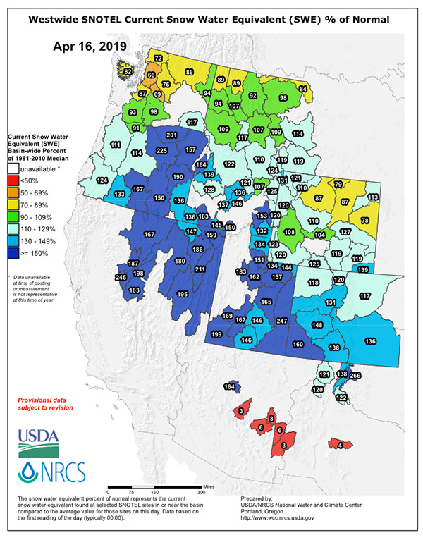
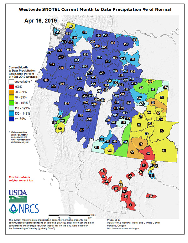
Snow Water Equivalents for the remainder of the west look pretty damned impressive in interior Oregon, southern Idaho, Nevada, Utah, and Colorado too, with the final image below confirming April has been very kind to snowpack building so far this month.
Three month modeling from the Climate Prediction Center still has the mid and northern Rockies receiving above normal precip for the April-May-June window; it would be great for western river flows for that to hold true. Time will tell.