Since the last snowpack post a little over a month ago, back home in Montana it’s been for the most part a genuine winter season per Jake, Kaitlyn, and Brantley in Livingston and for Jess in Missoula as well (as I write this note at close to 0730, it’s 16 and 8 in Lvn and Missoula, some of the warmest morning temps they’ve both seen in days.)
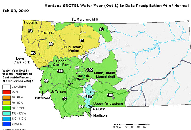
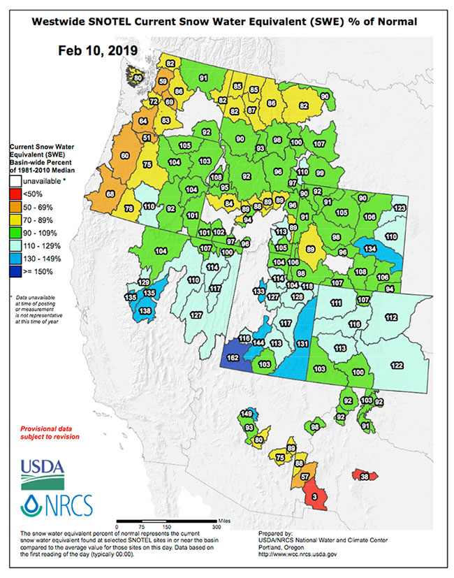
Both current snow water equivalent (first image below) and the water year to date (second image below) show decent snowpack for this time of year, with numbers for most of the state close to the longterm historical average, and there’s decent snow in the forecast for much of the state this week.

Parts of the West have been getting pounded this season so far; friends in Utah keep telling ridiculous tales about the snow season underway at their top tier ski resorts (the SLC bundle and Park City). Both Utah and Colorado have gotten winter and the snowpack season off to a great start as per the image below.
Longrange forecasts suggest the northern Rockies won’t stay on this pace during the critical spring snowpack season; keep doing that snow dance…