The USGS has a nifty set of images up for view using visible and infrared light to capture stunning pics of earth features from space. They have an intro vid (image above) you can see here and peruse the high-res images here.
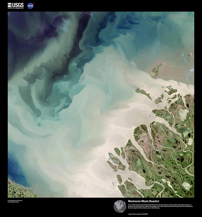
The sample image below: In far northern Canada, pulses of freshwater flow down rivers after inland ice and snow melts. These pulses, known as a freshet, carry huge amounts of sediment. The sediment seen in this image flowed into the Beaufort Sea from the Mackenzie River, the longest northward-flowing river in North America.