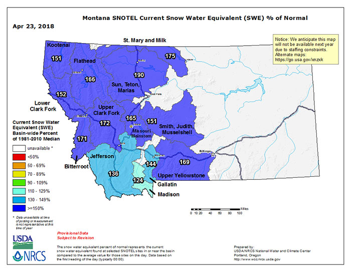
Talking to the clan back home, and with my lovely wife back in Montana for five days last week, it’s pretty clear that most folks are reaching the end of their ropes when it comes to what has been a long and wet winter. That bodes quite well for the snowpack though, and through yesterday morning (not counting yesterday’s storm obviously), Montana’s SWE (snow water equivalent) data looks mighty impressive for the last week of April…
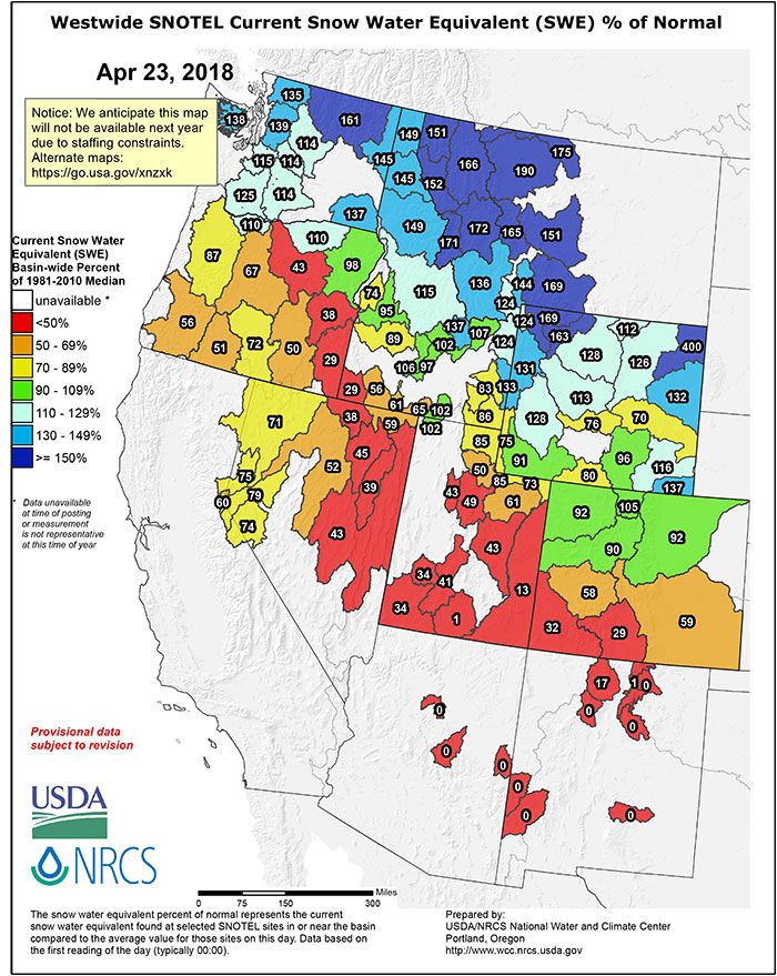
Things are a bit more sobering the further south you wander down the Rockies, though northern Colorado has been playing catchup during the month of April at least…
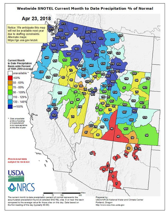
April Precipitation in the West
Speaking of April, it brought a lot more than the fairy tale April showers for much of the West as shown in the map below – that’s April’s precip compared to normal…
Montana’s Water Year Has Been a Good One So Far
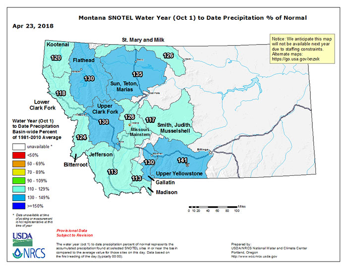
All Montana basins are reporting above normal precip for the Water Year (starts 1 Oct), with more to come during the month of May. There’s going to be a good runoff scour this year no doubt…