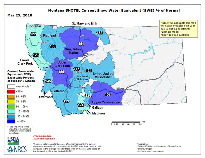
Snow Water Equivalent (SWE) as of yesterday shows most Montana basins with an embarrassment of riches when it comes to the amount of snow tucked away in the high level snowpack, and there’s still some serious snowpack building season yet to come. Low level snow has been coming off for a few weeks now with typical early spring warming, pushing flows on some waterways, but clearly there will be a genuine runoff this year at some point.

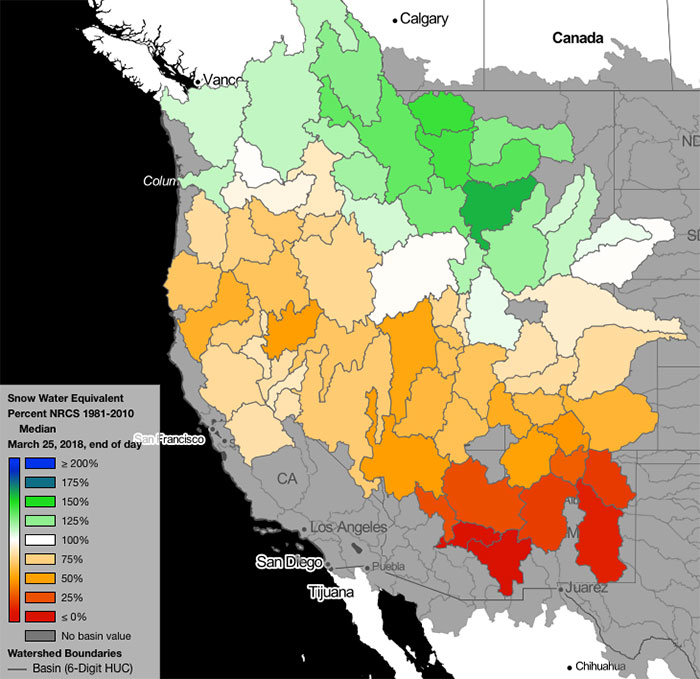
Here’s a new map covering the current SWE in the West by basin; note the scales are different than the top map above. For those who like to tinker with interactive maps, it was cut from the NRCS National Water and Climate Center data portal here.
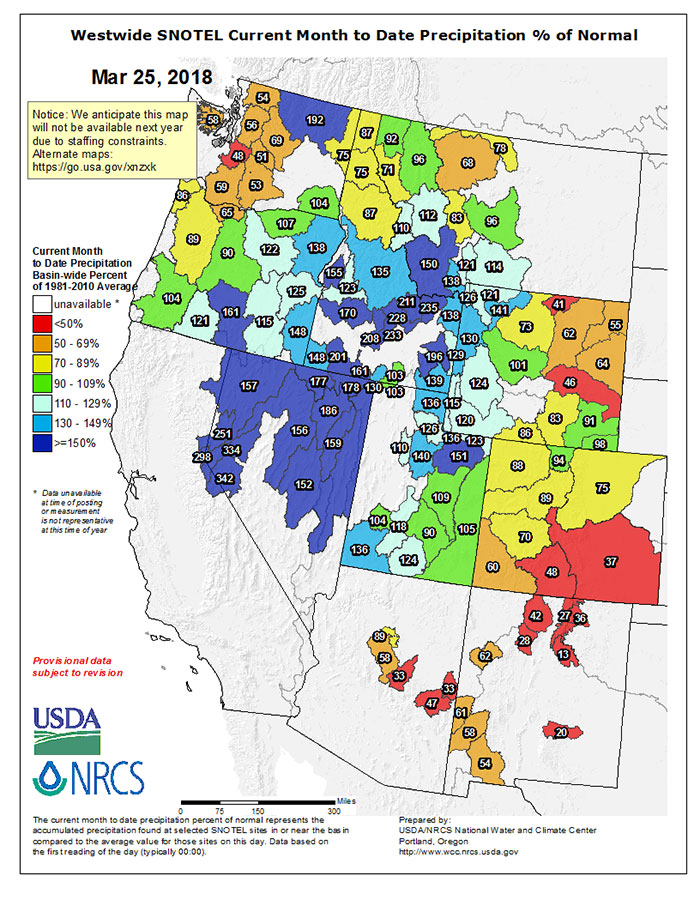
Finally, the map below shows actual precipitation to normal across the West for March; interesting to see the bounty of mid-spring snows shift slightly south into Southern Idaho, Nevada, Utah, and Western Wyoming.


