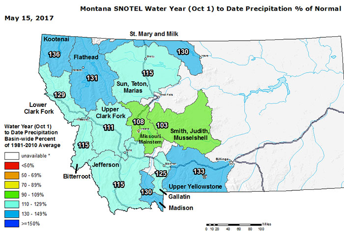
There’s no way to otherwise describe the current Water Year for Montana – it’s been a very good one thus far as per the graphic below (note – the official ‘water year’ starts annually 1 October…).

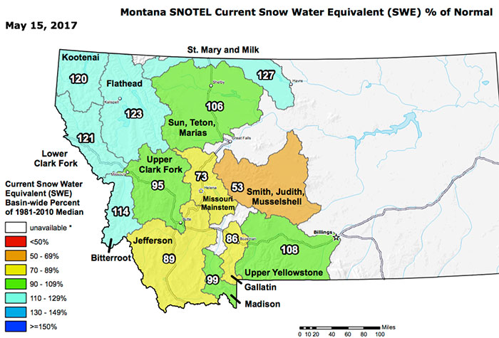
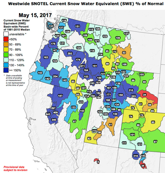
Perhaps even more importantly, the amount of water stored up in the hills in terms of snowpack remains damned impressive at this point in the year, even after a burst of warmth in the past few weeks, as indicated by the Snow Water Equivalent data for Montana and the West below.
Wyoming, Northern Utah, and Southern Idaho in particular have SWE levels not seen in years.


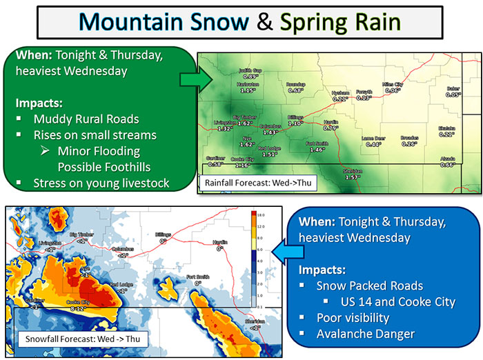
And to make the story this morning even better, there’s a significant late season rain and high country snow event rolling in to impact the Northern Rockies over the next three days – some of the mountain country in south central / southwest Montana is due 18 inches of new snow according to the forecast map below.

Hot damn.

