Depending on where you might call home in the Northern Rockies, you’ve seen anywhere from a “decent” snow year thus far to a “hells bells, this is the best ski season in decades” year in Northern Utah.
Snow Water Equivalent (SWE) is a great way to track at least one feature of winter’s snow fly fishers are interested in – how much water is sitting up there in the hills to come trickling out (hopefully) over the upcoming two quarters in particular.
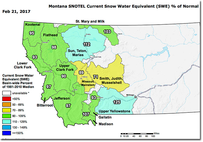
Montana SWE by basin isn’t bad but it’s not great as of this morning –
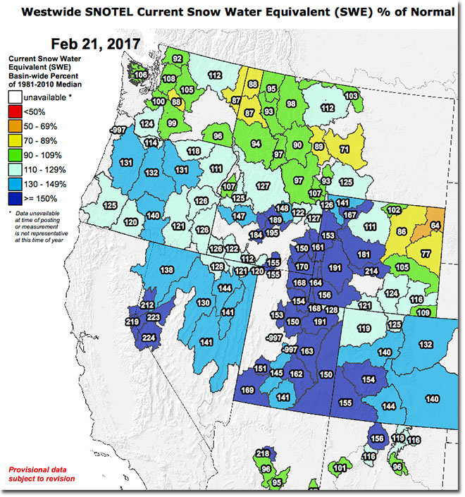
Looking at the rest of the Northern Rockies, current SWE numbers are pretty damned good for this time of year, particularly when compared to the last few winters –
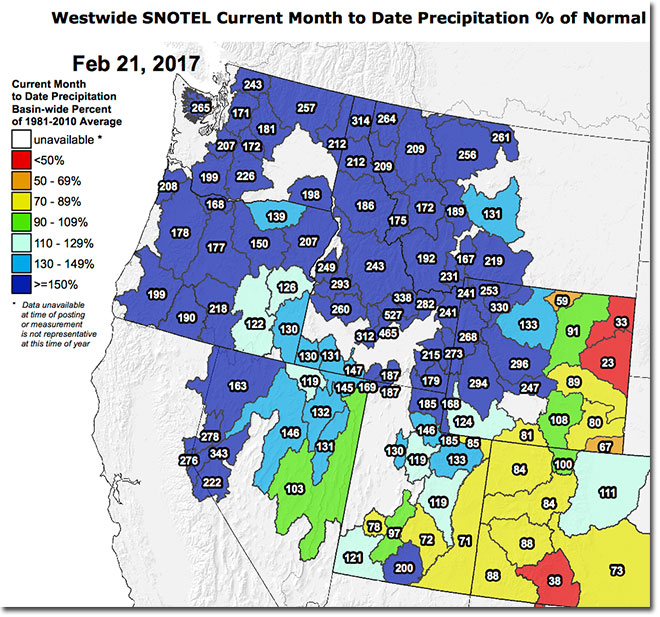
It’s somewhat interesting to look at February snowfall (contribution to snowpack) in terms of percentage of normal for the month of February – Montana was clearly behind before the snows in early February and has done a bit of catching up over the past few weeks –
It’s about time to enter the serious snowpack building interval for the Northern Rockies (March, April, May); don’t stop doing that snow dance just yet.
More data, some updated daily, here on the NRCS Water Year Page for Montana.