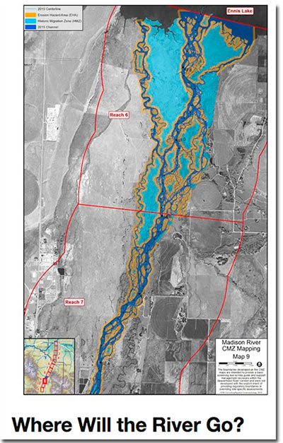
 The Madison Conservation District is holding a Madison Channel Migration Zone Mapping meeting this evening at the Ennis Elementary School from 430-630.
From their site page –
The patterns of change along a river can be barely noticeable, or very dramatic- depending on a number of different factors. Their patterns are known for being a bit mysterious, yet a new mapping effort might be able to give us an idea of where we can anticipate change in the future and help land managers and agencies better consider the river in the decisions on the land.
A result of a partnership of multiple organizations in the upper Missouri area, the Channel Migration Zone mapping initially started in 2012 by the Ruby Valley Conservation District. With mapping efforts currently underway on six rivers, some draft maps are now ready to present to the public in the Madison Watershed. Interested community members are invited to attend the December 14th meeting at 4:30 PM at the Ennis Elementary School cafeteria, to learn about the mapping process and to provide feedback on the current maps.
The goal of project is it to provide a cost-effective and scientifically-based tool for land managers, property owners, and other community members to use for making land use decisions along river corridors.

