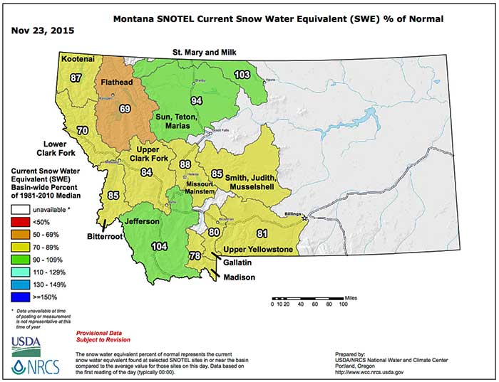
It’s snowpack season in the Western US and for late November, things are off to a pretty decent start as you can see from the maps (as of today 23 November) above for Montana and for the West in general below.
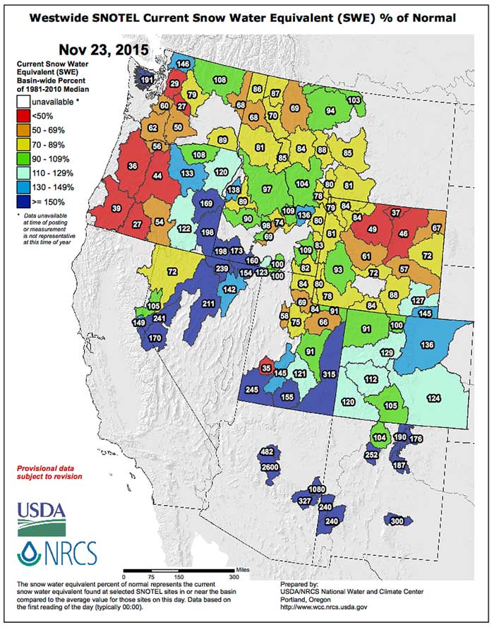
Values report are precent of normal snow water equivalent for this date; of course it’s damned early in the Western snowpack water year and things can – and probably will – change.
Here’s the ‘But’
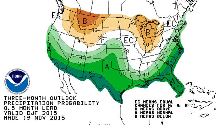
Weather gurus are still projecting a warmer and drier winter (as compared to normal / average) for the Northern Rockies; the graphic below is the precipitation forecast for the December-January-February window, which coincides with the peak of the El Nino now in place.
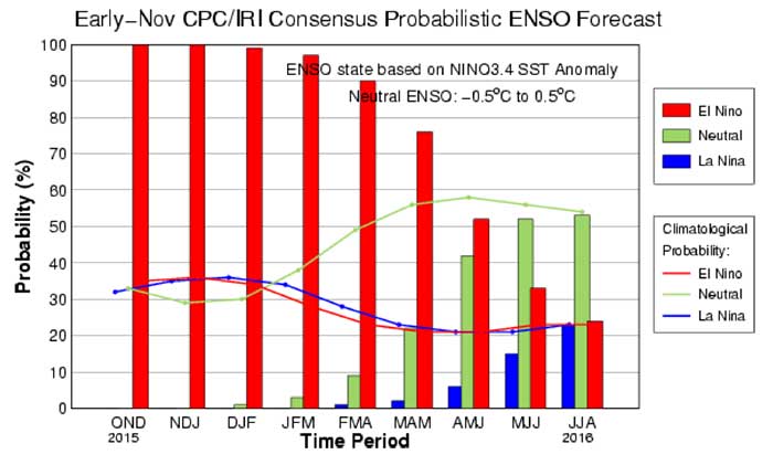
The most current El Nino report (Actually the ENSO: Recent Evolution, Current Status and Predictions report) was released by NOAH’s Climate Prediction Center today – read it here.
The final image is taken from that very report, and gives the probabilities of the persistence of the El Nino by rolling quarter, giving a bit of hope for some late winter / early spring snow season catch up in 2016 as the El Nino begins to break down fairly rapidly.
Time will tell.
Meanwhile, keep doing that snow dance.