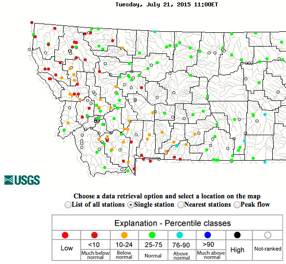
Today’s flow map at approx 9 MDT
A quick snapshot of the statewide flow map is pretty sobering. And while the weather over the past 7-10 days hasn’t brought the blistering heat of several weeks back, flows remain damned skinny keeping temperature stress risk high. Kudos to FWP for taking a proactive stance this year with early institution of Hoot Owl restrictions.
There are a number of Montana rivers on Hoot Owl Restriction (2 PM to Midnight); for many of the rivers only certain parts of the river are impacted. See the details here on FWP’s Fishing and Waterbody Restrictions & Closures page –
- Beaverhead
- Big Hole
- Bitterroot
- Blackfoot
- Clark Fork
- East Gallatin
- Flint Creek
- Gallatin (Sheds and down)
- Jefferson
- Madison (Ennis damn to confluence)
- Ruby
- Shields
- Silver Bow Creek
Keep doing your rain and mild weather dance.