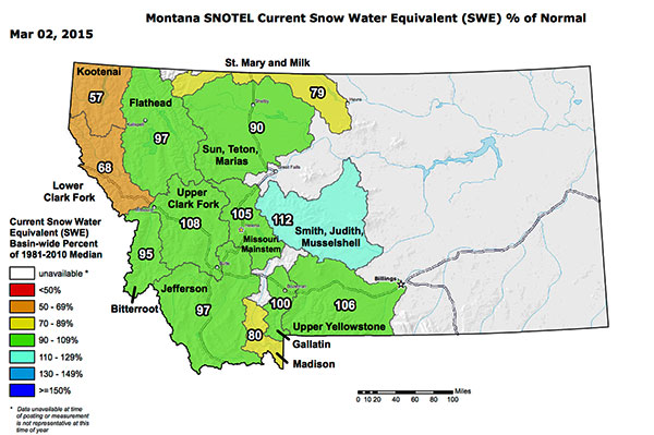
Despite a pretty damned unusual mid-to-late January and early February in Montana and other places in the Northern Rockies – meaning it was damned warmed at lower elevations – snowpack in terms of snow water equivalent is hanging in there.
What’s a bit strange about this year’s snowpack of as now is that the lower level snow is non-existent in many drainages and the mid-level snow is pretty damned skinny. More than one long-time fishing guide and shop guru is predicting little if any runoff if that situation persists.
Will mid- and low level snowpacks redevelop as we move into spring? Who the hells knows. Anything is possible at this point.
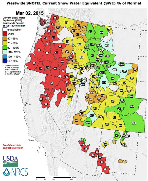
The much of the West can’t necessarily equal Montana’s snowpack claim – again this map displays snow water equivalents for Western basins.
ENSO data still leans toward El Nino conditions (drier and warmer than normal in much of the Northern Rockies), with a 50-60% chance of El Nino for late winter and early spring per today’s weekly ENSO Summary.
Keep doing that snow dance.