With the extended run of January’s ‘spring thaw’ weather persisting back in home country, fly fishers’ thoughts often turn to snowpack this time of year.
As of this morning, Montana snowpack (in terms of snow water equivalent in this map) doesn’t look too shabby.
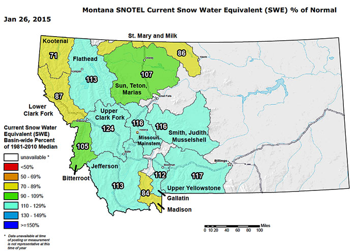
The next few month’s snowfall of course will shape the true state of the waters we’ll all be fishing over the next few quarters; the weather gurus are predicting perhaps a skinny start to the year. Precipitation looks to be normal though temps are forecast to be a fair bit higher than normal given what going on with the ENSO (El Nino Southern Oscillation) currently.
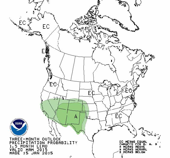
As of this morning’s report from NOAA’s Climate Prediction Center, they’re pitching a 50 to 60% chance of El Nino conditions during February and March (there’s more detail than you’ll ever care to peruse in the report…), though it’s likely back to ENSO-neutral conditions – read weather as per the averages – thereafter.
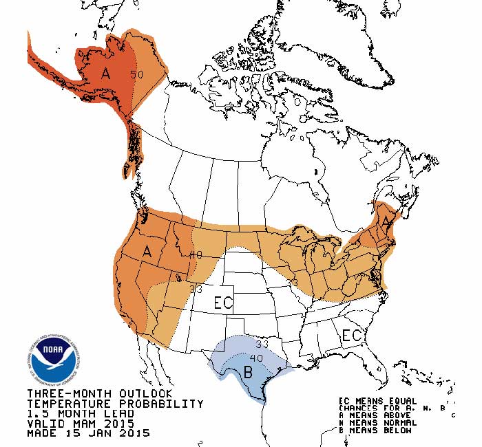
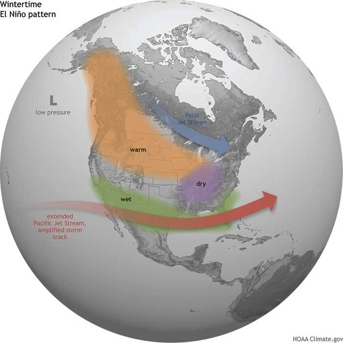
Here’s a quick graphic reminder of what typical El Nino conditions bring to the Northern Rockies (and the rest of the country).
Keep doing your snow dance.
El Nino image via NOAA Climate.gov.